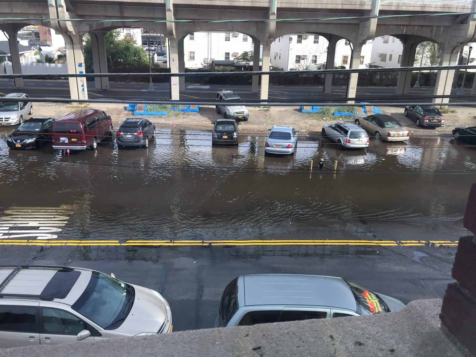
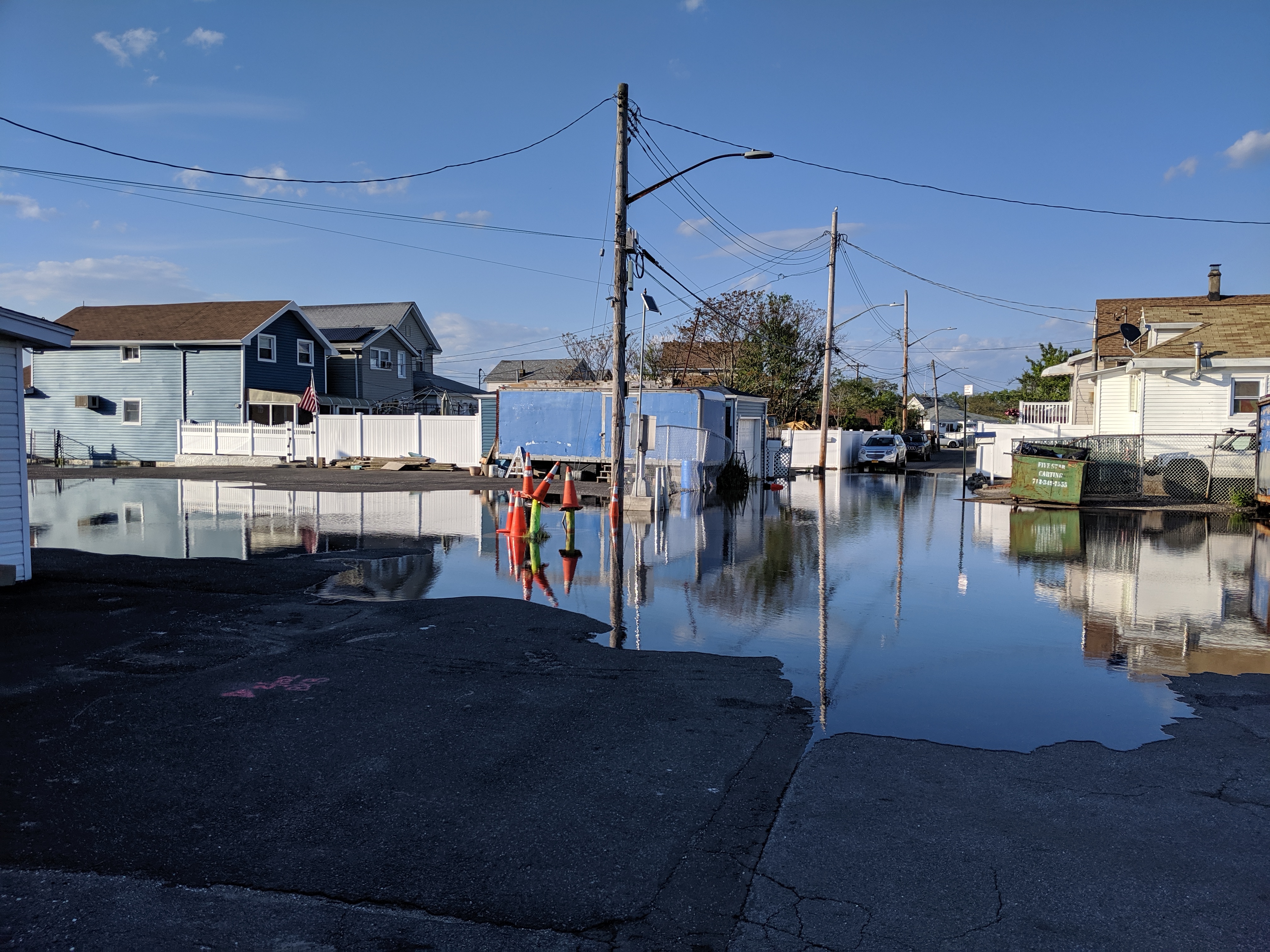
As sea level rises around NYC, coastal flooding is getting more frequent and widespread.
What can we do?
The Community Flood Watch Project is a growing network of residents and organizations who report local flooding, share experiences, and access resources related to flooding in NYC coastal communities.
Researchers use these reports to visualize how “normal” high tides could look in the future due to sea level rise, and to improve forecasts of flooding and coastal hazards.
Communities can use this shared database of images, reports and maps to communicate their neighborhood’s needs and visions to city leaders.
Flood Watch is co-led by New York Sea Grant, and produced in collaboration with the NYC Mayor’s Office of Climate and Resiliency, Stevens Institute of Technology, NYC Office of Emergency Management, US Forest Service Urban Field Station, and valued community partners:
New Hamilton Beach Civic Association, Broad Channel Civic Association, Meyers Emergency Management, Rockaway Initiative for Sustainability and Equity (RISE), Rockaway Beach Civic Association, City Island Rising Inc., Coney Island Beautification Project.
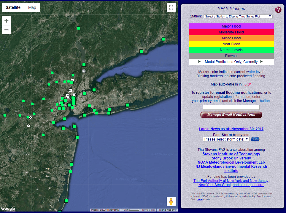
Sign up for localized flood alerts using the Stevens Flood Advisory System, a cutting-edge tool that integrates real-time observations and river and coastal flood models to produce street-scale flood forecasts during extreme rain events or storm surges.
NY Coastal Flooding Alerts
National Weather Service (NWS) New York
The OKX office covers the NY-NJ-CT tri-state area. The NWS is responsible for issuing local public, marine, aviation, fire, and hydrology forecasts. They also issue severe weather warnings, gather weather observations, and daily and monthly climate data for their assigned area. This page provides information and past data on coastal flooding in the area.
Know Your Zone NYC
New York City Emergency Management
KNOW YOUR ZONE is your destination for everything you need to know about hurricanes in New York City. You’ll find information about the city’s hurricane evacuation zones, the hazards you may face from a hurricane, and what to do to prepare.
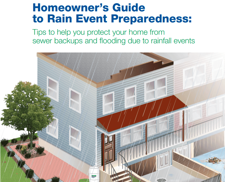
Home-owner’s Guide to Rain Event Prepared-ness
New York City DEP
This guide provides ideas for how to protect your home from risks, such as sewer back-ups and flooding, associated with rain events.
Notify NYC
NYC Emergency Management
As part of New York City Emergency Management (NYCEM), ‘Notify NYC’ is New York City’s dedicated emergency public communications program. Enroll here for New York City’s official source for information about emergency alerts and important city services.
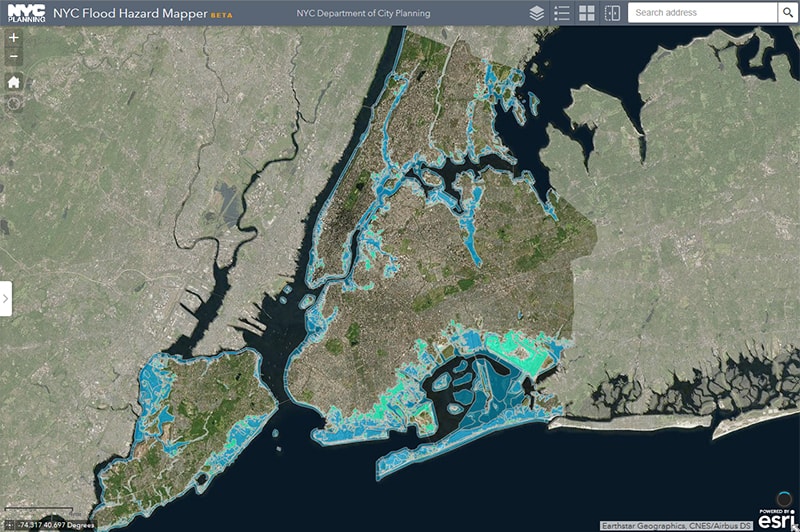
NYC Flood Hazard Mapper
New York City Planning
The NYC Flood Hazard Mapper provides an overview of the coastal flood hazards that threaten the city today, plus how these flood hazards are likely to increase in the future with climate change.
Plan for Hazards
New York City Emergency Management
Funded through the NY Governor’s Office of Storm Recovery and New York Rising, FloodHelpNY is a platform for engaging and informing NYC homeowners about how they can protect their home and finances from flooding that is expected to worsen with rising sea levels caused by climate change.
Flood Help NY
Center for New York City Neighborhoods
Learn your flood risk, learn how to be flood safe, and access information about ways to protect your home or business from flooding including insurance and retrofits.